 Picture by James Laing
Arctic tern seen over Luskentyre beach
 Picture by Kelvyn Skee
Luskentyre beach
 Picture by Stuart Beattie
 Picture by CaptainOates
Wild flowers near Luskentyre beach
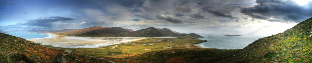
 Picture by James Laing
Panorama seen from Seilebost, view towards Luskentyre beach
 Picture by James Laing
View towards Luskentyre from the Coffin Road, with Loch Carran. The land in East Harris is so thin above the underlying rock, it is said, that it is not possible to bury the dead. Therefore this trail was used to carry the dead for burial to the deeper grounds.
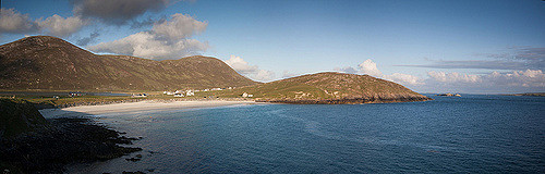
 Picture by fs999
Panorama seen from Horgabost, with Luskentyre beach
 Picture by Tim Haynes
Gneiss stones near Horgabost
 Picture by fs999
Rock formation near Horgabost
 Picture by Colin Campbell
Nisabost Beach with Taransay Island
 Picture by Colin Campbell
MacLeod Stone near Traigh Lar
 Picture by Ike ofSpain
Triagh Lar
 Picture by damian entwistle
Seilebost Beach
 Picture by CaptainOates
Traigh Mhor, "a coarse grained orange sand beach backed by monstrous dunes and subject to the full force of the Atlantic gales. Thunderous breaking waves are pretty common place here", writes transientlight.co.uk.
 Picture by Bob the Lomond
Ceapabhal from Borve Beach
Near Borve beach you find standing stone NG020939, on the west side of the road. The site is called Borvemore sometimes. The 2 metres tall stone has two fallen stones close by. Read more and see pictures.
 Picture by Bob the Lomond
Scarista Post Office
 Picture by Jim Barter
Scarista Beach
 Picture by Jim Barter
 Picture by James Laing
Machair, view of Scarista Beach
 Picture by James Laing
Traigh na h-Uidhe, Northton
 Picture by James Laing
Chapel ruin with Traigh na Cleabhaig
 Picture by Jim Barter
Panorama from Ceapabhal with Scarista Beach on the left
 Picture by Tim Haynes
Rodel Church
 Picture by Simon Varvell
Rodel Church
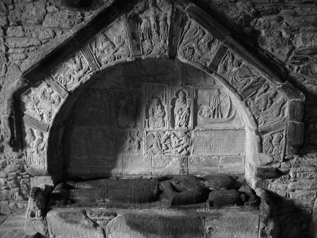
 Picture by ian
Carvings in Rodel Church
 Picture by fs999
View from Rodel
 Picture by Erik Erskine
Rodel with Roineabhal
 Picture by IrenicRhonda
Loch Seaforth
 Picture by Irenic Rhonda
Amhuinnsuidhe Castle. It was built in 1865 for the owner of the Isle of Harris, the 7th Earl of Dunmore.
 Picture by Piefke La Belle
Amhuinnsuidhe Castle offers accommodation, rumour says it is home to the ghost of Lady Sophie Scott who was also a resident of the Castle in Edwardian times.
 Picture by James Laing
Hushinish Beach
 Picture by Piefke La Belle
Rocks in Hushinish
 Picture by vandesign
Traigh Mheilein
 Picture by Colin Campbell
Scarp island
Read more:
The South Harris machair: sources and settlements by Emma Anderson
An Etymological Dictionary of the Gaelic Language
No comments:
Post a Comment